
29.Tateno Gorge Geosite
Intersection of fault activity and volcanic activity
Geologists believe crater lakes repeatedly formed and disappeared in the Tateno Gorge area in relation to activity along the fault that runs under the gorge. The gorge also plays a central role in local creation myths, making this a fascinating geosite both culturally and geologically.
Long, long ago, a huge lake covered the caldera basin in what is today Asodani Valley and Nangodani Valley. According to legend the god Takeiwatatsu-no-mikoto drained the water from the caldera and created the villages and fields where people now live.
Takeiwatatsu-no-mikoto was sent to Mt. Aso by his grandfather, Emperor Jimmu, to rule central Kyushu. When the god arrived and saw the abundant water filling the caldera, he thought to himself that if only the lake were drained, the land would be excellent for growing rice. So he looked around and found a section of the caldera wall he thought he could kick down. He drew back his leg and gave the wall a tremendous kick. However, because the mountains in that spot were two layers thick, they would not budge. Today this part of the caldera rim is called Futaenotouge Pass, meaning double-layered pass.
Takeiwatatsu-no-mikoto moved a little further south and tried kicking the wall again. This time he was successful and the wall came crumbling down. But he had kicked so hard that he fell on his backside and cried out, "I can't get up!" or "Tatenu!" in Japanese. That is why the gorge where the water flows out is called Tateno. As the water flooded out in a torrent, it carried away several deer, giving Sugarugataki Falls their name: "sugaru" means "several deer washed away." Still, some of the water remained because the giant catfish that had lived in the lake were obstructing the flow. So Takeiwatatsu-no-mikoto took his sword and chopped them up. Finally the last of the water drained from the lake, leaving the basin that we see today.
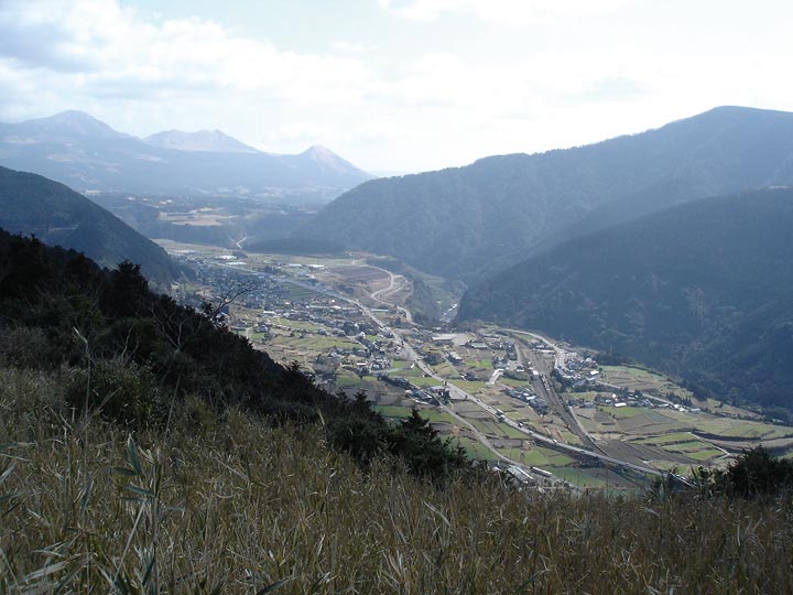
Tateno Gorge
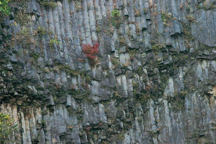
Tateno Gorge is the sole gap in the caldera wall, caused by a seismic fault running underneath it. The fault has been filled with lava a number of times, damming the flow of water and leading to the formation of a lake inside the caldera. The plateau visible in the center of the photograph was created when lava filled an ancient valley.
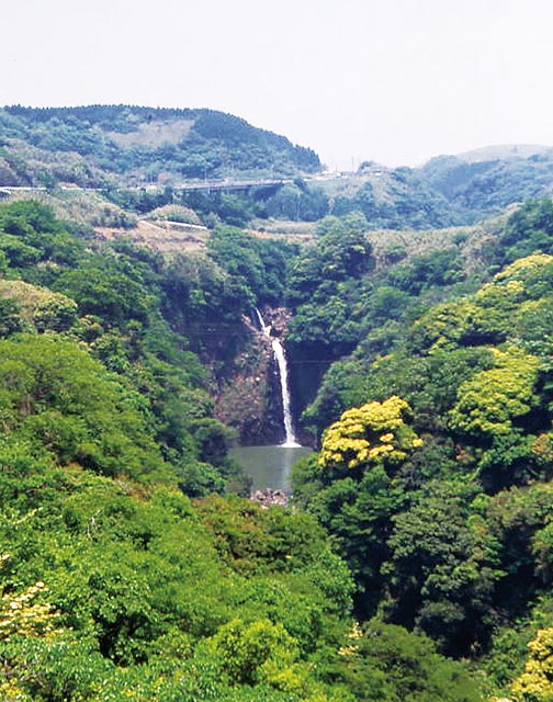
Ayugaerinotaki Falls
Located in the lower reaches of the Shirakawa River, which runs through the southern section of the caldera, this waterfall measures 20 m high and 30 m across. The waterfall's hard rock layer is basaltic lava (ayugaeri lava), which experts believe dates to the period immediately following the caldera's formation. Basaltic lava also forms the river's bedrock bottom above the falls. Downstream the river runs through deep gorges.
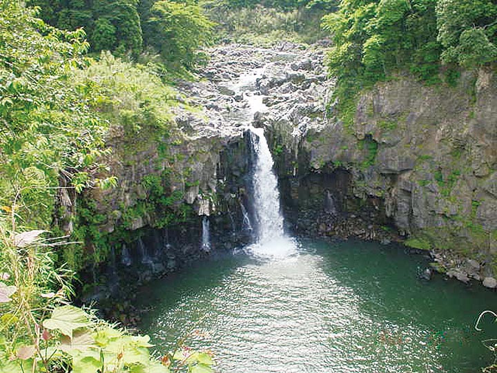
Sugarugataki Falls
Located in the lower reaches of the Kurokawa River, which runs through the north of the caldera, this waterfall measures 60 m tall and 30 m across. The hard rock layer is made up of andesite lava (akase lava), which also forms the river's bedrock above the falls. Downstream the river flows through deep gorges.